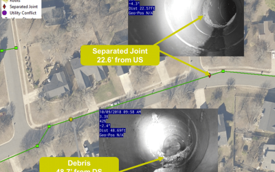
Supporting the City of Charlotte’s expanding asset management initiatives, ESP completed a uniform and up-to-date inventory of the city’s entire drainage system. For this effort, our team was assigned 128 work areas that totaled approximately 105 square miles and contained an estimated 135,000 open- and closed-system drainage features. ESP leveraged Esri mobility applications with high-accuracy GPS equipment to collect and report inventory collection in real-time. To meet the city’s 2021 project completion goal, ESP developed a work plan for the assigned collection areas and performed pre-field data compilation/processing to maximize collection efficiency in the field.
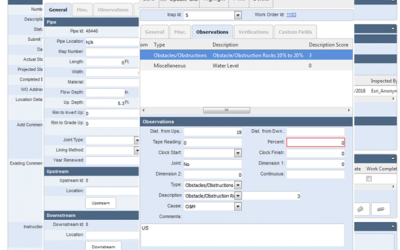
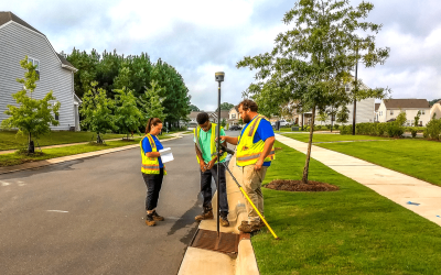
This effort included configuring an inventory database per the city data model and setting up a collection application, preparing and loading supporting datasets, and determining field workflows. ESP had two to four crews working in the field to collect drainage features using Arc Collector, Trimble GPS units, and appropriate measuring devices. Data collected in the field was stored/reported in real-time to a cloud-hosted database where it was reviewed and processed using a series of procedures and customized tools to package the data in deliverable format.