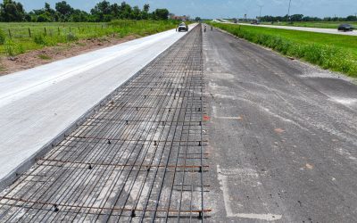
CivilCorp, an ESP Company, provided project management, surveying, right-of-way (ROW) mapping, utility coordination, and PS&E (plans, specifications, and estimates) to reconstruct 7.8 miles of US 59 from FM 961 to SH 60 in Wharton County, widening the stretch of highway from four lanes to six lanes. US 59 design upgraded the facility to interstate standards for the future I-69 corridor, including interchanges at FM 961, FM 102, FM 1301, and stream crossings at the Colorado River, Baughman Slough, and Peach Creek. Surveying included horizontal and vertical control points, existing bridge details, Colorado River cross sections, a 3D DTM model for Bentley ORD production, ROW map, and parcel plats. Metes and bounds descriptions were also prepared for 30 parcels.
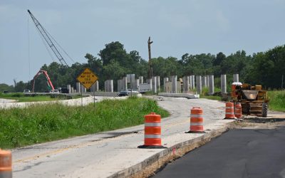
Schematic refinement proved challenging, being confined to the originally published schematic ROW footprint while incorporating entrance and exit ramp locations, frontage road connectivity, and access between interchanges. A proposed U-turn on the north Colorado River Relief channel provided circulation and access to Bucee’s and Nanya Plastics Plant south of FM 102. Ramp designs were improved for safety and constructability. Design included the multi-phased traffic control plan (TCP) with positive barrier to maintain high speed freeway traffic through the work zone and provide for the safety of motorists and construction crews.
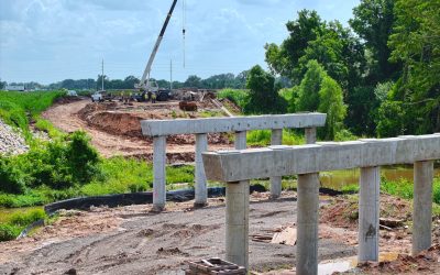
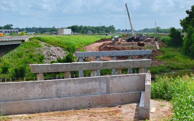
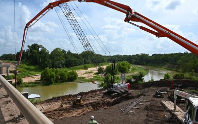
For this project, our team performed analysis and design of substructure, foundations, calculated loads on abutments, and bents per AASHTO specifications and TxDOT requirements. Bridges included 11 stream crossings at Colorado River South Relief, Colorado River, Baughman Slough, and Peach Creek, ranging from single-span frontage road bridges to 21-span main lane Colorado River Bridges (NB and SB) of over 2,000 linear feet of bridge length with varying skew angles and super-elevation transition.
This project required coordination with TxDOT’s Environmental Affairs Division and the US Army Corps of Engineers for a 408-permit approval of the Levee at ML Colorado River Bridge. We also coordinated extensively with utilities along the project corridor to accelerate utility conflict resolution. Major efforts were made to relocate high-priority utilities, enabling early relocation of CPE transmission towers and eliminating the need to relocate two oil and gas pipelines. Our PS&E and utility teams worked closely to reduce the need for relocations during the design phase by assessing all facets of project design against existing utility horizontal and vertical locations. The utility team created a utility conflict matrix and utilized frequent meetings and design to relocate utilities per specifications via TxDOT’s utility accommodation rules.
With the complexity of the project, a Primavera P6 construction schedule was developed and used to estimate the construction duration and identify critical project milestones. We prepared a construction management plan outlining critical utility relocation timelines and phases of work to prevent any contractor claims or project delays.