ESP has served the South Carolina Department of Natural Resources (SCDNR) Flood Map Modernization Initiative since 2014. As one of only two prime contractors supporting the initiative, our team provides a variety of data and application development, floodplain/risk mapping, disaster recovery support, outreach, and general program support services to meet needs statewide for several significant initiatives, including disaster response from the historic storms Joaquin, Matthew, Florence, and Dorian.
For storm support, ESP developed a field collection and web mapping application to aide with damage assessments, provided UAS reconnaissance at four sites to document flood stages, prepared rainfall depth and storm event probability maps to aid in the identification of hardest hit areas, and provided technical expertise on flood predictions. Working with SCDNR and other contractors to support multiple state and federal agencies, our team also prepared flood inundation mapping and identified impacts to buildings, roads, dams, critical facilities, and other significant features. We are honored to have been recognized by SCDNR for exceptional service during and following the October 2015 Flood and Hurricane Matthew in 2016.
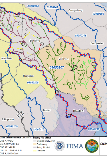
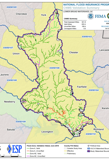
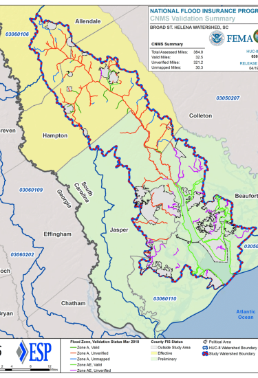
ESP also supported FEMA’s Coordinated Needs Management Strategy (CNMS). This digital inventory of all FEMA mapped streams is evaluated and checked every five years to assess the adequacy of floodplain mapping. Our team performed validation for more than 11,000 miles of streams. The validation process involves the compilation of numerous data sets that impact floodplain mapping (e.g., land use, topography, gage data, etc.) and a series of detailed checks to assess the magnitude of changes and the subsequent validity of effective floodplain boundaries. The validation effort also included base level engineering (BLE), hydrologic and hydraulic (H&H) modeling, and floodplain mapping for nearly 3,000 miles of streams to assess potential floodplain changes.
Additionally, ESP performed flood insurance study (FIS) updates for five watersheds, covering portions of 18 counties and totaling approximately 5,500 square miles. This work involved restudying more than 600 miles of streams and producing updated FIS products. ESP’s task orders and support also included independent technical review of engineering analysis and mapping associated with approximately 400 miles of flood study updates and 2,200 square miles of 2D modeling; lidar acquisition and enhanced processing of lidar for five counties totaling nearly 3,000 square miles; and development of a web-based portal for viewing general and watershed-specific flood information.