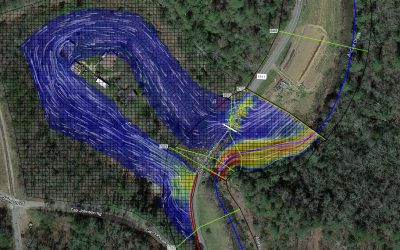
Since 2012, ESP has supported North Carolina’s floodplain mapping program (NCFMP) through the completion of more than 160 diverse delivery orders, including eight Letters of Map Revision (LOMRs) and 22 Conditional Letters of Map Revision (CLOMRs) for DOT projects.
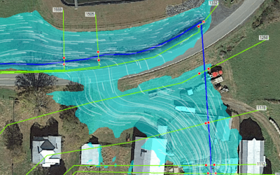
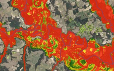
For the FY2009-16 Map Maintenance Digital Flood Insurance Study Updates, ESP was the prime firm for map maintenance studies of 18 counties. These studies included more than 2,000 miles of detailed and limited detailed H&H modeling. These studies included unique components such as highly urbanized detailed HMS models and future conditions modeling and mapping for Durham and Orange Counties. The studies also included a complex split-flow analysis for East Back Creek in Alamance County, lake routing and analysis in Orange County, and levee modeling and seclusion in Robeson and Surry Counties. These studies culminated in the production of NCFMP’s leading, fully digital FRIS website, developed by the ESP Team –
fris.nc.gov. Alamance, Cabarrus, Chatham, and Orange counties were released preliminarily and are now effective. Other counties led by ESP are in various stages of preliminary issuance.
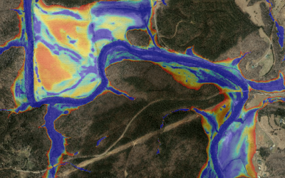
In early 2013, following the release of the initial seven eastern river basin effective back-populated geodatabases, the NCFMP required that the back population for the western river basins be expedited. ESP was assigned the Yadkin River basin, which has a drainage area of over 7,200 square miles and is the second largest basin in the State. The project included over 5,320 miles of studied stream; 1,686 unique hydraulic models; 8,705 unique hydrology basins; 5,869 survey photos; 903 survey sketches; Issue Paper 69 rasters (502 sq miles); 32,007 field survey data points; and incorporation of 29 LOMRs.
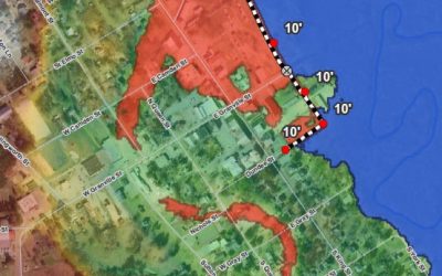
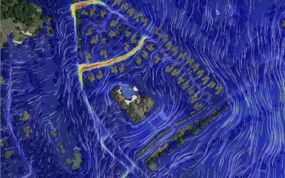
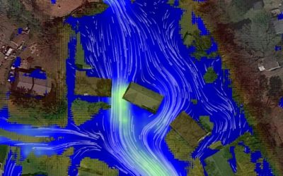
As a pioneer in mobile lidar since 2010, ESP also leveraged this technology for cost-effective and highly accurate collection of over 4,300 miles of roadway lidar for the sea level rise project, topography augmentation in Durham for map maintenance, profile of the Lumberton Levee, and FFE collection in Carolina Beach. Other ESP services provided to the NCFMP have included ortho-photo collection, QL2 lidar, building footprint generation, FFE collection, gage installations, mapping libraries, FLOOD geodatabase creation, risk assessments, risk map product development, IHRM support, website/application development, and field surveys.