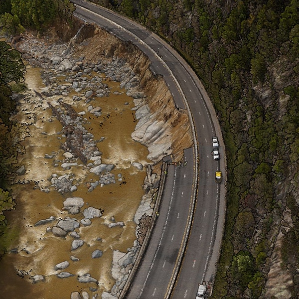
Immediately following Hurricane Helene, the ESP team mobilized to support NCDOT with the section of I-40 that collapsed into the Pigeon River Gorge near the NC/TN state line. For approximately 5 miles of I-40 and the Pigeon River from the state line to the Waterville Lake Dam, ESP’s survey team deployed a SkyFront Perimeter 8+ UAS to collect high-resolution oblique and nadir imagery, as well as high-density lidar point clouds for terrain surface development.
In addition to UAS data, ESP also collected mobile lidar of the roadway and surrounding areas, ran baseline control, and collected full surveys of the damaged storm structures. ESP’s water resources team also developed a detailed 2D hydraulic model for the 12-mile reach of Pigeon River, including pre-conditions, Hurricane Helene simulation, and post-erosion simulations. This advanced modeling will assist with the I-40 rebuild/repair.
Our thoughts are with all those affected by Hurricane Helene, and we stand ready to support our communities in their efforts to assess and rebuild critical infrastructure.


