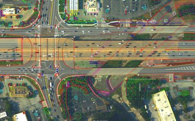
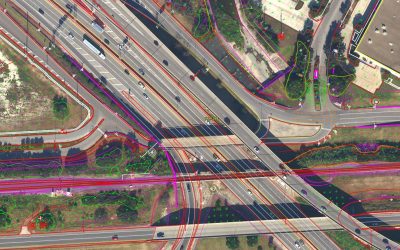
ESP provided remote sensing and land surveying services for the design and construction of this approximately 17.5-mile of TxDOT highway facility within the City of San Antonio, Texas. The project area consisted of a corridor, centered on the roadways of interest, meeting minimum coverage requirements of 1,000 feet of width (centered on the interstate centerline), 2,000 feet at major intersections (centered on bridges), and 1,500 feet beyond furthest ramp connections.
Mobile lidar was used for mapping within the right-of-way, and aerial lidar and traditional photogrammetry were used for all areas outside of the right-of-way. Mobile lidar exceeded the minimum accuracy requirement of 0.06-foot RMSEz. Aerial lidar was collected at a density of >35ppsm and exceeded project accuracy requirements of +/- 0.10-foot RMSEz on hard surfaces. Aerial imagery was collected at a raw GSD of 2.7 inches to support 3-inch orthophotography and stereo mapping.