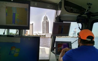
ESP mobilized survey vessel “Eridanus” and a shallow draft recon vessel to complete hydrographic surveys along the I-10 corridor crossing Mobile Bay for the Alabama Department of Transportation. Survey vessel “Eridanus” our state-of-the-art hydrographic survey vessel is equipped with an Edgetech 6205 Interferometric Swath Bathymetry Sonar and Applanix POS MV 320 Ocean Master positioning and motion sensing system.
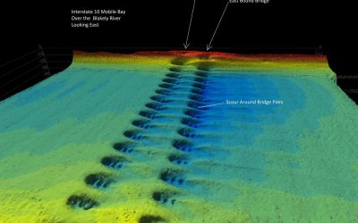
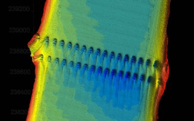
The project involved single and multibeam bathymetric data collection along the existing I-10 dual bridge eight-mile alignment and within a portion of the Port of Mobile. Our survey vessel was utilized to collect full-bottom multibeam bathymetry for all deep water portions of the project. Multibeam data was collected on the Blakely, Apalachee, Tensaw, Spanish, and Mobile Rivers and along portions of the old barge canal constructed between the existing I-10 bridges.
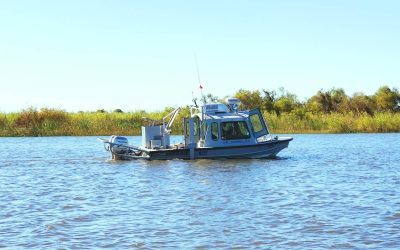
Shallow water areas along the alignment were collected using our shallow draft recon vessel equipped with two independent single beam Hydrolite systems, two Trimble R8survey grade GPS receivers, and two TSC3 data collectors, providing redundant survey-grade single beam data collection. Multibeam and single beam data were edited and processed using HyPack HySweep software. The final digital terrain model of the seabed was processed, modeled, and quality controlled using Trimble Business Center TerraModel and ESP Analyst software.