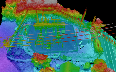
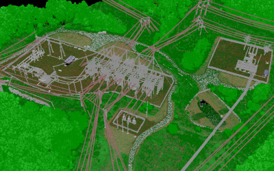
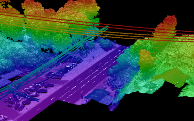
ESP and Pickett, an ESP Company, provided surveying and mapping services to support the construction of a new 230kV transmission line, rebuild of an existing 115kV line as a new double circuit, and routing new lines and connects at three substation sites. These services included airborne and terrestrial lidar, digital imagery, and topographic mapping services for three substations parcels and 8.6 miles of connecting transmission line near Asheville, NC. Field services included control and target panels, terrestrial scanning for the substations, weather stations, aerial lidar collection, and digital color imagery.
Final deliverables included ortho-mosaics, classification of the lidar point cloud, and planimetric mapping in PLS-CADD. Additional features were extracted from terrestrial scan data inside the substation fences. Additional points of attachment and structure base and top points were added, and the classified data was feature coded in PLS-CADD according to the client’s specifications. Planimetrics and ortho were attached to the PLS-CADD model for reference. The lidar-derived DTM was utilized to produce contours and generate topographic maps of the substation parcels, with planimetrics merged from both airborne and terrestrial sources.