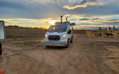
ESP completed a comprehensive pavement data and mobile mapping collection and analysis for 350+ miles in Adams County. Despite a short collection season, data was collected within a two-week period on a compressed timeline. Using our IrisPRO Pave multi-sensor van and Riegl VMX-1HA mobile lidar system, ESP mapped every road in Adams County, providing over two million points per second of survey-grade lidar data with correlated high-quality imagery.
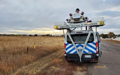
Our team also provided full pavement collection data from dual LCMS-2 sensors and an inertial profiler and collected data from various roadway sites multiple times to carefully calibrate data to state pavement standards. This combined dataset allows the County to make informed and strategic decisions related to sidewalks, curbs, and signage for years to come.